MMJD 1243 GEOHAZARD INFORMATION FOR DISASTER RISK ASSESSMENT
Course Schedule : *Dates to be announced later
*Students are required to attend all lectures and complete 2 course assignments (group presentation and course report) to get certification. Please check for schedule updates with course coordinator.
Course Synopsis :
This course provides better understanding of geological risk assessment by utilizing quantitative methodologies. It focusses on the physical-, geotechnical- and geomorphological based approach for assessing complex landslides and debris flow, with the support of advanced geospatial technology. It highlights mapping, monitoring, and modelling of complex slope failures, rain-fall induced shallow landslides and earthquakes induced landslides. A comprehensive landslide hazard and risk assessment at different scales will be discussed in interactive sessions. This course also emphasize the importance of rapid provision of high quality geoscientific information for decision makers and explores multi hazard and risk assessment methodologies, review of frameworks and strategies at local, regional and national scales, in different physiographic, climatic and geological settings.
Course Coordinator :
Dr. Khamarrul Azahari Razak
Disaster Preparedness and Prevention Center (DPPC)
Malaysia-Japan International Institute of Technology (MJIIT)
Universiti Teknologi Malaysia Kuala Lumpur
Jalan Sultan Yahya Petra, 54100 Kuala Lumpur, Malaysia
E-mail: khamarrul.kl@utm.my
Profile of Course Lecturers :
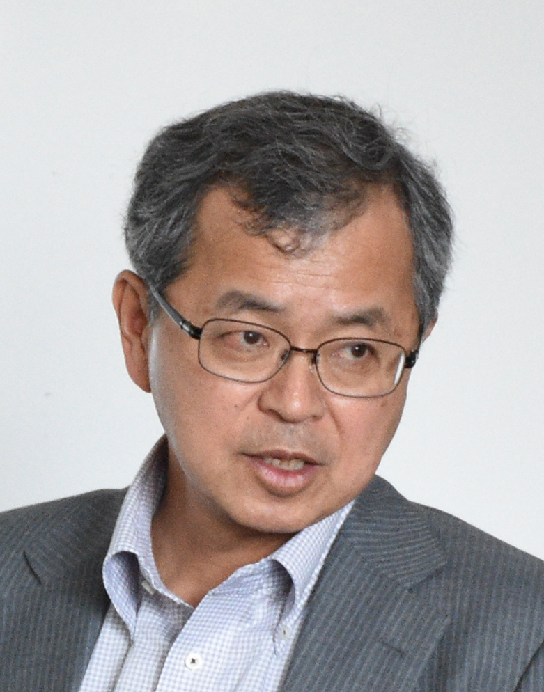
Masahiro Chigira (Prof. Dr.)
Professor
Professor Masahiro Chigira is a Professor and the Chair of Fukada Geological Institute, Tokyo, Japan.
Professor Chigira is an expert in the mountain geohazards, particularly debris slides, mass rock creep and rock weathering. He has vast experienced as gained from working experience for the Central Research Institute of Electric Power Industry until 1997. His recent studies have focused on gravitational deformation of mountains and the mechanism of gigantic landslide and weathering of various rocks and the mechanism of shallow landslides. He has conducted field works in major post-disaster events, including 1999 Taiwan Chi-Chi Earthquake, 2002 Typhoon Rusa in Korea and 2003 Chuetsu Earthquake in Japan.
Professor Chigara is a graduate of Tokyo University (BS, MS, PhD, Geology).
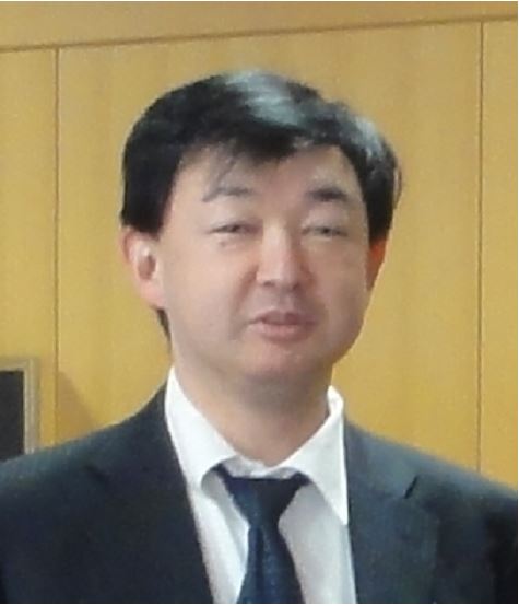
Naoki Sakai (Dr.)
Senior Researcher
Dr. Naoki Sakai is Director of Center for Advanced Research Facility National Research Institute for Earth Science and Disaster Resilience (NIED), Japan.
Dr. Sakai is an expert in geotechnical engineering with experience of conducting extensive studies on soil erosion research, simulation for slope failures and monitoring of slope destabilization process due to groundwater movement with emphasize on the technological advancement and sensor development. He was one of core researchers in the Science and Technology Research Partnership for Sustainable Development (SATREPS) project funded by the Japan Science and Technology Agency for reducing geohazard damage in Malaysia.
Dr. Sakai is a graduate of Chiba University (BS, MS, Geophysics) and Nagaoka University of Technology (PhD, Civil Engineering).
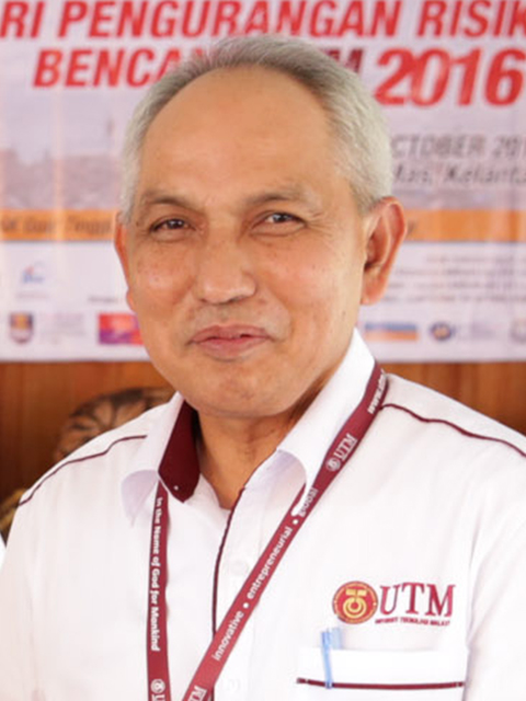
Zakaria Mohamad (Dato')
DPPC Research Fellow
Dato’ Zakaria Mohamad is a National Fellow of Universiti Kebangsaan Malaysia’s Southeast Asia Disaster Prevention Research Initiative (SEADPRI-UKM).
Dato’ Zakaria is the former Director of Mineral & Geosciences Department, Malaysia (JMG) under the Ministry of Natural Resources and Environment (NRE) and currently a National Fellow of SEADPRI-UKM. An engineer experienced both as practitioner and researcher in geoscience disciplines including geological mapping, engineering geology, geological hazards, environmental geology, geophysics, he is a member of Board of Study (BOS) of the Disaster Risk Management Programme of MJIIT and Chair of the International Association of Engineering Geology Malaysia.
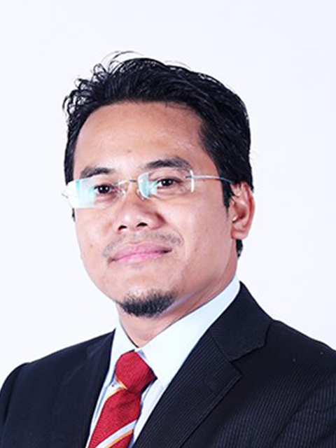
Khamarrul Azahari Razak (Dr.)
Senior Lecturer/Director of DPPC
Dr. Khamarrul Azahari Razak is a Senior Lecturer in Razak Faculty of Technology and Informatics (RFTI) UTM Kuala Lumpur.
Dr. Khamarrul research interests have been in the area of Multi-geohazard and Disaster Risk Assessment, Cascading Geohazard Mapping and Analysis, Quantifying Complex Landslides Processes Using Geospatial Technology in the Tropics, Mapping, Characterization and Modeling of Hillslope and Tectonic Geomorphologic Processes and Activities and Community-based Disaster Risk Reduction. He is an active member of several academic societies in the Geoscience field. He is the Director of Disaster Preparedness and Prevention Centre (DPPC).
Dr. Khamarrul is a graduate of UTM (BSc Hons Geomatics Engineering, MSc Geomatics Engineering) and Utrecht University, the Netherlands (PhD Geosciences & Remote Sensing).